Cabora Road

Due to the sensitive native habitat of the bluffs and out of respect for local residents, Visitors should abide by these Rules of Cabora Road:
  1. Stay on the paths and and off of the slopes. Not only is it dangerous to traverse the steep hillside, it is also private property. Staying on the paths will also help maintain the recently restored native vegetation on the bluffs, which helps to anchor the hillside during the rainy season.
  2. Please keep all pets on a leash along the path and remember to pick up all pet waste. If not disposed of properly, pet waste can wash into gutters and storm drains while carrying dangerous diseases into local ocean waters. Remember, it is illegal to not pick up your pet's waste.
  3. As sound travels easily in open natural spaces, please be respectful of residents living both atop and below the bluffs and keep the noise to a minimum.  
Cabora Road is actually quite long and has the potential to be a great multiuse hiking, walking and biking trail from Sepulveda on the east to the ocean. This unique, unimproved road runs along the entire length of the Westchester Bluffs. Here you can get a wonderful view of the Ballona Marsh restoration work, see Marina Del Rey, and view the historic hanger where the Hughes HK-1 (Spruce Goose) was built along with its 1940's administrative building. Viewing further north you can see high rises along Wilshire and Santa Monica, and see the Santa Monica Mountains.

As a multiuse hiking, walking and biking trail, Cabora Road could tie in the Osage, Westport and other neighborhoods on the east side of Westchester with Kentwood and Playa Del Rey and provide all of our communities a wonderful, safe way to hike or bike to the ocean without having to traverse the streets.  

DSC00174.JPG (152008 bytes)

DSC00163.JPG (145477 bytes)

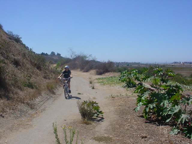
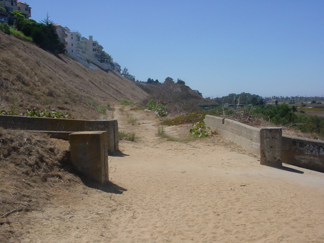
This view of Cabora Road where it wraps around the West Bluffs is looking west nearby Lincoln Blvd. The road is popular with cyclists and hikers who know it's there. At the bottom of Hastings Canyon are a couple of concrete brick walls and stairs leading down into the salt marsh. Here we are less than a mile from the Pacific Ocean.
Cabora Road could eventually be tied into a planned Wetland Interpretive Center adjacent to Lincoln Boulevard (Playa Vista), a K-8 Environmental Magnet school (LAUSD) and a system of trails with signage and rest stations along the way pointing out wetland and bluff habitat.

DSC00172.JPG (154827 bytes)

DSC00173.JPG (156654 bytes)

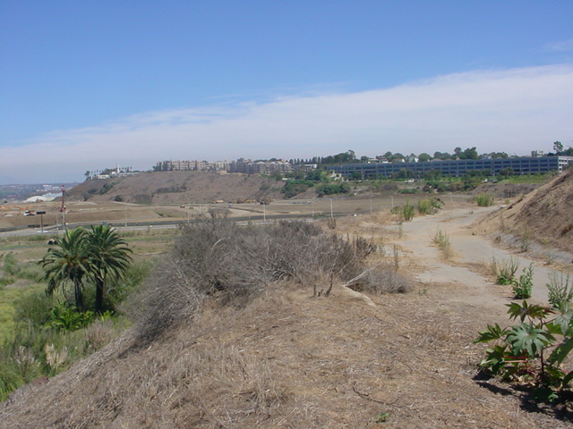
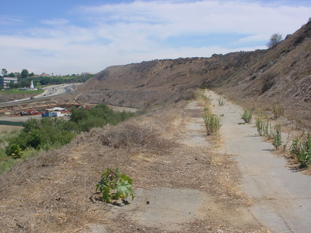
Still on the West Bluffs side but looking east on Cabora Road you can see LMU (right), fresh water marsh (left) and if you look closely you can see portions of Cabora Road on the east side (middle) of Lincoln Boulevard. Another view where Lincoln Blvd is readily seen on the left.
Where is it? - One way to reach Cabora Road which has mixed ownership is by its entrances on the east and west sides of Lincoln Blvd near Jefferson. In addition there are two paved trails that lead down from atop the bluffs in Kentwood.

Back to Westchester Playa Del Rey Facts